
Tracing a Jamestown Street Directory
A street-by-street search works best when the starting address is written exactly as known, including a directional word or unit when one exists. County systems can return close matches, and the same postal city can extend beyond the City of Jamestown. First establish the municipality and parcel. Then treat an owner name, a deed party, a voter result, and a directory line as separate observations. This order prevents a mailing address or a historic entry from being mistaken for a present household.
- Search the address in the Chautauqua County GIS Parcel Viewer. Turn on Parcels or Tax Parcels, Address Points, and Municipal Boundaries, then record the SWIS and tax-map identifier shown with the parcel.
- Use the Parcel History Database to compare address, owner, deed-information, sales, and current or old parcel-number modes. Its links separate tax information, ownership history, and property details.
- Read the dated assessment roll for the property location, current owner, owner mailing address, class, account number, school district, and deed-book reference. Those fields are joins, not proof that a person lives there.
- Follow the owner and legal-description trail into County Clerk land records. A deed gives the recorded transfer parties and date, while the legal description helps bridge parcel changes.
- For a dated household clue, use the library directory street section and its map. New York voter lookup is an exact-information service, not a public street roster, so use it only through its stated rules.
That sequence makes a Jamestown street directory search reproducible. Save the date checked and the exact field that produced each result. When nothing appears, record whether it was absent from GIS, PHD, the assessment roll, or the deed index rather than treating one no-result as a final answer.
Note: Postal city, municipal boundary, ward, election district, and parcel SWIS are separate geography fields and should remain separately labeled.
Jamestown Street Parcel Fields
The County Parcel History Database supports tax-map, deed-information, owner-name, address, and sales searches. Its tax-map search includes a municipality or SWIS selector, and the current-number and old-number choices matter when an address history crosses a parcel change. The county says its parcel data is updated weekly, but it also labels the display informational. Use it to locate the right record, then confirm legal ownership and boundaries through the official land record.
| Field or control | Use in a street search | Important limit |
|---|---|---|
| Situs or property location | Supplies the street-address starting point from a roll or property page. | Keep postal city separate from municipality. |
| Owner name | PHD and GIS allow it as a search facet. | Current owner is not evidence of occupancy. |
| Mailing address | Appears as a result field on assessment and property records. | It may be different from the parcel situs. |
| SWIS and tax map | Provide the preferred parcel join across GIS, PHD, rolls, and deeds. | Use old-number search when the current number fails. |
| GIS address or owner search | Finds a parcel or matching outlined parcels in the viewer. | Address searches can return close matches; owner popups can require Next Page. |
| Attribute Table and layers | Shows parcels in the map extent with parcel actions and layer controls. | Layers have scale thresholds and the table refreshes as the map moves. |
The 2025 Jamestown assessment-roll format makes the distinction plain: it labels both property location and current owner’s address. It also carries assessment, exemption, school-district, account, special-district, parcel-size, and deed-book fields. A road-level search becomes stronger when the street address is joined to its tax map, not when a familiar name is repeated across unrelated sources.
Jamestown Streets in County GIS
The GIS viewer is the map half of a Jamestown street directory. Search by address, tax ID, or owner name. After the map centers, zoom far enough for parcel lines to render and inspect the address point instead of relying on a label alone. The viewer offers parcel, owner, address-point, municipal-boundary, school, fire, agricultural-district, tax-map annotation, contour, and imagery layers. Many are off by default, so a blank map does not mean the data is unavailable.
For a named street, pan along the road and use the Tax Parcel Attribute Table at the bottom of the view. It refreshes with the visible extent. Clicking a parcel opens actions for tax information, ownership history, and property-information details. This is a useful way to inventory parcel evidence along a block, but it is not a list of people living there. The map supports current geometry and property links, not a complete household directory.
The county parcel-viewer instructions describe the search icons, layer controls, popup pages, and attribute-table behavior. Capture the map scale and view date when comparing adjoining parcels, because the table changes as the map moves.
Jamestown Address Record Coverage
Each address-keyed system answers a narrower question. The coverage below keeps the records in sequence, from current parcel identity to dated municipal action and historical household clues. The Jamestown street directory does not combine these into one claim about residency.
| Address record | Custodian or channel | Street-level value | Access and caution |
|---|---|---|---|
| Assessment roll | Chautauqua County Jamestown roll PDFs | Situs, owner, mailing address, class, account, value, and deed reference | Dated public tax snapshot, not occupant evidence |
| Parcel History Database | County PHD | Tax map, owner, address, deed information, sales, tax-card and GIS links | Public web; informational display |
| Parcel Viewer | County GIS | Parcel geometry, address points, municipal and district context | Public web; layers and scale affect what is visible |
| Land instruments | Chautauqua County Clerk and SearchIQS | Grantor, grantee, instrument, recording date, book or page | Subscription gateway or Clerk public computers; copies have county fees |
| Permit and code files | Jamestown Department of Development | Address, municipal action, and dated permit or notice trail | Availability varies; an applicant or respondent is not an occupant |
| Printed directories | Prendergast Library and local-history collections | Dated name and address clues, including street sections | Historical snapshots, not current-residence proof |
No reviewed source provides a public utility-customer list, DMV street roster, or a citywide resident master file. The state voter lookup requires name, date of birth, county, ZIP, and address information for an eligible registered voter. It is a person-specific verification path, not a way to enumerate a road.
Note: A source label should say owner, mailing recipient, deed party, or dated directory entry instead of calling every name a resident.
Jamestown Street Deed Continuity
Land instruments for Chautauqua County are recorded by the County Clerk, not by a separate Jamestown deed office. The County Clerk lists deeds and mortgages from 1811 forward. For a parcel found through GIS, use the tax map and the deed-book reference from the assessment roll to locate the transfer record. A grantor is the party conveying an interest; a grantee is the party receiving it. Neither label establishes who slept at the address.
SearchIQS divides the online deed path at the 1979 transition. Deed books 1 through 1822 cover June 25, 1811 through January 31, 1979 in Index Books, while book 1823 forward begins February 1, 1979 in the Solution application. A chain that appears to break at that boundary needs a search in the other interface or a Clerk inquiry. It is not sound to call the missing link nonexistent.
The Chautauqua County Clerk land-recording page explains how the office handles instruments and copy requests.
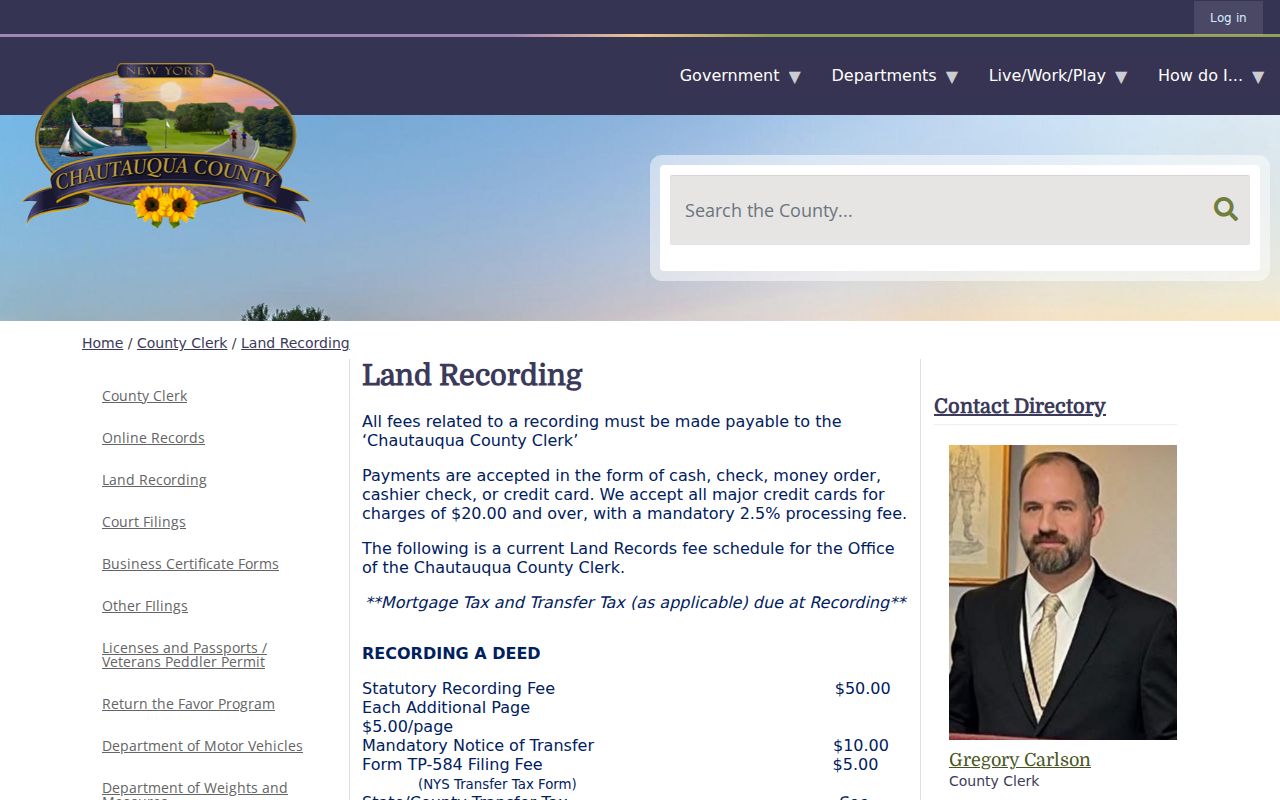
Use the Clerk’s land-record copy channel when an index result is not enough. The county lists a general copy baseline of $1 per page with a filing minimum, while instrument recording charges and transfer taxes are separate rules. County public computers offer an alternative when the SearchIQS login or subscription path does not expose the needed record.
Jamestown Street Record Terms
Street research becomes less error-prone when the labels in the county records remain intact. A street address is useful for finding a parcel, but property history is anchored by identifiers and legal language that may survive a changed number or boundary.
- Parcel
- A tax-map unit used by the assessment and GIS systems. In Jamestown examples, the identifier uses a dotted format such as 370.10-1-2.
- Situs address
- The physical property location. It is different from an owner mailing address and does not itself name a resident.
- Plat or survey
- A map or survey record used with a deed’s legal description to understand lot, boundary, or subdivision information.
- Criss-cross directory
- A reverse-style address arrangement used to locate a printed household clue by street. The reviewed Jamestown material verifies street sections in historic directories, not a separate current reverse-directory run.
When an old address does not fit the current parcel, search PHD by old and new number, then compare the recorded legal description. Store the historical address as printed and the current matched address as separate fields. That preserves uncertainty rather than forcing a one-to-one match.
Jamestown Streets Need Two Maps
Current GIS linework and historical maps answer different questions. The county viewer shows today’s parcel boundaries, address points, municipal layers, and property links. The Library of Congress Jamestown Sanborn item is a March 1886 set of 15 sheets that documents street layout, structures, use labels, and fire-insurance context. It does not list residents and should not be used to infer a person from a building.
No reviewed official source supplied a citywide Jamestown street-renumbering or renaming crosswalk. That gap matters. The safer method is to compare the directory’s street section and map, query GIS by current address, test PHD’s old-number and new-number modes, and then use the deed’s legal description and tax-card scan. Preserve both forms of the address if the connection remains uncertain.
Current ward names also need their own date label. The city’s ward map names College I, Lakeview II, Chadakoin III, Bergman Park IV, Forest V, and Willard Heights VI. Those are not automatically the wards or election districts printed in a nineteenth-century directory.
Jamestown Street Directory Snapshots
For past households on one address, the relevant shelf is the city-directory run listed by Prendergast Library from 1875 to current, subject to confirming an individual volume. The digitized 1892-93 volume includes a street and avenue directory, map, wards, and election districts. The 1898-99 volume adds a street, avenue, and alley arrangement. The 1899-1900 book describes a street section arranged by household and explains its abbreviations, including the important “street implied” convention.
Read a printed street line as a dated clue. Record the volume, page or image, the line exactly as printed, the street number, and the map or street-section check. The historic publication area can include Falconer, Lakewood, Celoron, or people receiving Jamestown mail, so the printed word “Jamestown” alone is not municipal proof. The fuller collection context belongs with the Jamestown city directory collections.
Directories can supply names, spouse or household clues, address text, and abbreviations. They cannot establish a current household. Pair a useful line with parcel evidence and a later dated source before drawing a careful historical conclusion.
Jamestown Parcel Detail Check
The county’s official sample parcel-property detail shows the kind of fields that make an address record useful: tax code, description, deed book, sewer type, street address, acreage, frontage, depth, sale reference, building style, year built, square footage, and bedroom or bath fields when populated.
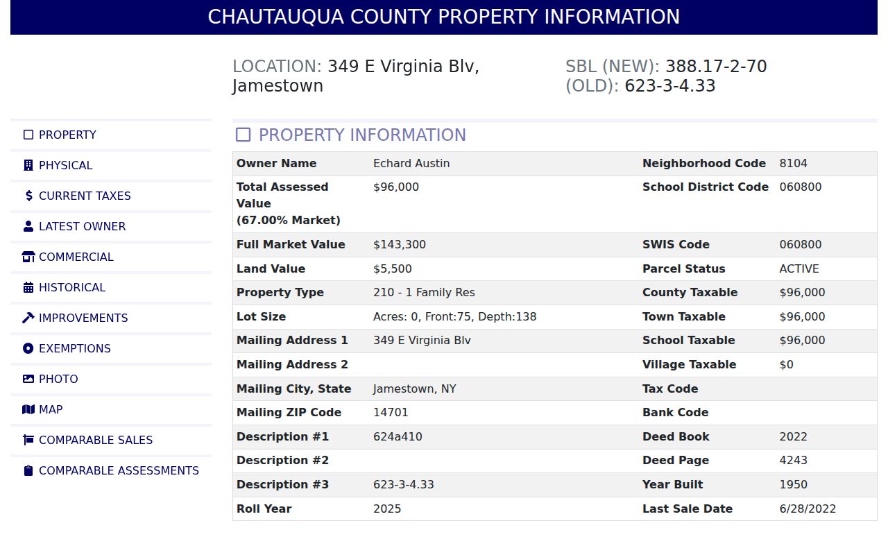
Its page links outward to current GIS, ownership history, a printable report, and tax-card scans. Those destinations represent different evidence paths. They should be checked individually, with the displayed values refreshed before any property-specific claim is made.
Jamestown Street Directory Limits
A street search can identify public parcel and recorded-land evidence. It cannot prove every person at an address. Owner names, mailing fields, permit applicants, code respondents, historic directory lines, and publicly available voter results all have different meanings. New York’s Address Confidentiality Program, confidential voter registration, court restrictions, and DMV privacy rules also create real limits on what can appear in a public search.
For a current question, label the evidence narrowly and verify it with the office that keeps the record. For a past question, retain the source date and accept an unresolved address match where the records do not support more certainty.